Main / Sights
GORELY VOLCANO
The active volcano Gorely is located in 60 km from Petropavlovsk-Kamchatsky at the high dale of Gorelinsky in 900-1000 m over the sea level. The volcano is the ridged massif of 1829 m height that rises from the bottom of the pillow-like caldera. Earlier there was a high shield volcano with the bottom diameter of about 30 km. The top part of the volcano emptied and formed a 9x14 km caldera, and in different times the craters were erupting there. The craters overlaid and the growing cones joined. And in the result we can see the stretched massif.
In the times of earlier eruptions the lava flows mixed with weak materials emissions. Lava flows and blocks cover almost all caldera bottom and the slopes of the central cones. Evidently, the volcano was named Gorely (Burnt) for the abundance of burnt rock lava.
Despite the simple appearance of the volcano, the so called collection of the top craters is unique. In the west the chain of craters starts with the extinct one - the West Crater. It is surrounded by small rocky ridges, the bottom is covered with scoria and glacier. It gives way to the rapid brook which forms a lot of small waterfalls on its way. Then there is a crater bunch that consists of several different-aged craters. The oldest and the biggest one is surrounded by the small ridge in the north, and in the south it borders with the break – the ridge of the permanently vapouring Active Crater. This crater is the centre of eruptions nowadays. The extended crater is 250x100 m in size and about 100 m in depth. Before the last eruptions there was a shallow orange lake at the bottom of the crater.
There is a flat 150 m area covered by scoria at the south slope of the volcano. In the east part of the area there is a shallow crater of explosive origin. It has the regular cylindrical form and is called Cylinder. In the east part there is the biggest crater – the Blue Lake. Its irregular 500 m crater is surrounded by the vertical 150-200 m ridges. Earlier the bottom of the crater was under the blue lake, but now the lake is absent. The group of the interesting craters ends in the east with the Bowl Crater. It is located at the top of the low regular cone and is surrounded by narrow range. The inside and outside slopes are rather steep. There is a small lake at the bottom of the crater.
Gorely Volcano eruptions occurred in 1828, 1832, 1855, 1869, 1929-1931, 1947, 1961, June 1980 - July 1981, 1984-1986. Eruption in 1929-1931 were characterized by strong explosions and ash falls on the Pacific coast, the city of Petropavlovsk-Kamchatsky and the village of Nachiki. The longest dormant period during the whole historical period was 60 years. The last eruption occurred in 2010. At the end of June, 2010, a steam-gas eruption of Gorely volcano started. It has been found that at the base of the northeast wall of the crater with an active thermal acid lake there was formed a crater about 20 meters in diameter. The lowest edge was only 5-7 meters above the lake level. The hot gas went out under great pressure and its temperature reached 1060°C, it ignited in the atmosphere. The crater glowed in red-crimson color during the day and a constant low hum was heard. Over the stream of hot gas there was formed a vapor column, which height reached 300 meters. Particularly impressive the eruption of gas looked at evening and night. The eruption lasted until 2014.
To climb the Gorely Volcano, it is necessary to make a 3-hour drive from Petropavlovsk-Kamchatsky to its foot along a poor gravel road. The way lies through the Vilyuchinsky Pass, from where you can enjoy beautiful views of the Vilyuchunsky Volcano and the valley of the Paratunka River.
The ascent begins in the caldera of the volcano, which is located at an altitude of 1000 m and ends at its top, which is 1829 m. It runs along a well-defined trail and takes about 3 hrs. It takes about 1 hour to explore the Blue Lake and Active Craters. The descent from the volcano lasts about 1,5 hours and takes place along the ascent path.
Tours
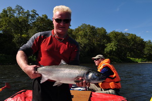
 Rafting and fishing. Volcanoes Avachinsky and Gorely
The Bystraya-Malkinskaya River heads in the Ganalsky Ridge foothill and flows from the centre of Kamchatka peninsula to ...
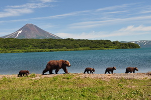
 Kurile Lake. Volcanoes Gorely, Avachinsky and Tolbachik
We would like to offer you tour to the extraordinary by its beauty Kuril Lake, where you are to watch the brown bear ...
